New in African Primates 20, Thomas M. Butynski and Yvonne A. de Jong
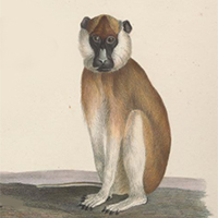
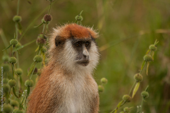
The spelling of the eastern patas monkey’s subspecific name has long been inconsistent, with both ‘pyrronotus’ and ‘pyrrhonotus’ in use, and with varying authorities and years cited. In this Brief Communication, we trace the confusion back to the original works by Hemprich & Ehrenberg. The name first appeared as Cercopithecus pyrronotus in 1829. The same authors then used ‘pyrrhonotus’, meaning ‘red back’, in 1833. Applying Articles 32 and 33 of the International Code of Zoological Nomenclature, we conclude that the valid name, authority, and year for the eastern patas monkey is Erythrocebus patas pyrrhonotus (Hemprich & Ehrenberg, 1829).
Eastern Africa Primate Diversity and Conservation Program, Nanyuki, Kenya
The River Prinia Prinia fluviatilis Chappuis, 1974, is a small passerine of the family Cisticolidae, restricted to waterside and water-logged, sometimes seasonally dry, vegetation in otherwise arid landscapes. Its distribution consists of a series of isolated wetland “islands” along the Sahelian belt, from northern Senegal in the west to northwestern Kenya (Urban et al. 1997; BirdLife International 2018; eBird 2026). The eastern-most record was obtained by Finch (2005) in 2001 near Nanam (520 m asl), 20 km southeast of Lokichokio, Turkana County, extreme northwestern Kenya. This was an eastward range extension of about 2,500 km from southwestern Chad, and the first record for Kenya and East Africa.
Northern Kenya is the most poorly known region in Eastern Africa as concerns the taxonomy, distribution, abundance, threats, and conservation status of its larger mammals. Nonetheless, this region is known to hold a high number of threatened species and subspecies. Among the larger mammals, 19 species of antelope are known to occur. During November 2025 to July 2026, we completed ‘Phase Three’ of the ‘Horn of Africa Antelope Survey’. Phase Three consisted of two field trips in northwestern Kenya covering as much of the land area as possible in the region west of Lake Turkana and Suguta Valley (i.e., west of the Eastern (Gregory) Rift Valley), north of Kainuk, east of the Uganda border, and south of the Elemi Triangle. In addition, we conducted two shorter surveys, one in far western Laikipia County (4 days) and one in the vicinity of the Merti Plateau (7 days), central Kenya. Diurnal surveys, nocturnal surveys, and camera trap surveys were conducted by two researchers (total of 47 field days; total distance driven 5,883 km).
Along the border with Ethiopia, on the Mandera Plateau, lies Kenya’s Malka Mari National Park. This national park (hereafter ‘Malka Mari’) was gazetted in 1989 and is situated southwest of the Daua (= Dawa) River in Mandera County. Rugged outcrops on both sides of the Daua River Valley are part of a limestone series known as the ‘Daua Limestone’ (Weir 1929; Ayers 1952). Erosion gullies deeply dissect the lower Daua Valley in northern and eastern Malka Mari, while part of the Awara Plains occur in southern Malka Mari. Contiguous with Malka Mari, across the Daua River in Ethiopia, lies Geraille (= Gerale) National Park (386 km²) which was gazetted in 2006.